-40%
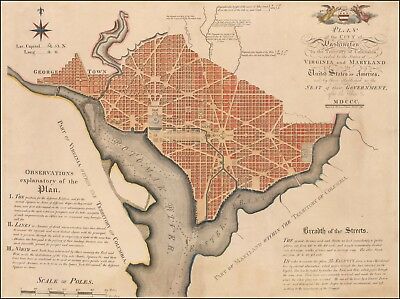
1792 map First Official Plan of Washington D.C. Andrew Ellicott POSTER 45626dw
$ 8.44
- Description
- Size Guide
Description
This Auction is for aLARGE
(see dimensions below) unframed
MODERN REPRINT
of an Antique Map as detailed below.
This map is reproduced on 35 lb heavyweight coated paper for sharper print quality and colors that are vivid.
Approximate Image Size
16.5 X 22 inches
Description
First Official Plan of Washington D.C. Plan of the City of Washington in the Territory of Columbia. ceded by the States of Virginia and Maryland to the United States of America, and by them established as the Seat of their Government after the Year. MDCCC.
The First Official Map of Washington D.C., Based Upon Andrew Ellicott's Original Drawings.
Nice example of Andrew Ellicott's seminal Plan of Washington, the first official map of the City of Washington, then the future capital of the United States.
---from Barry Lawrence Ruderman Antique Maps
