-40%
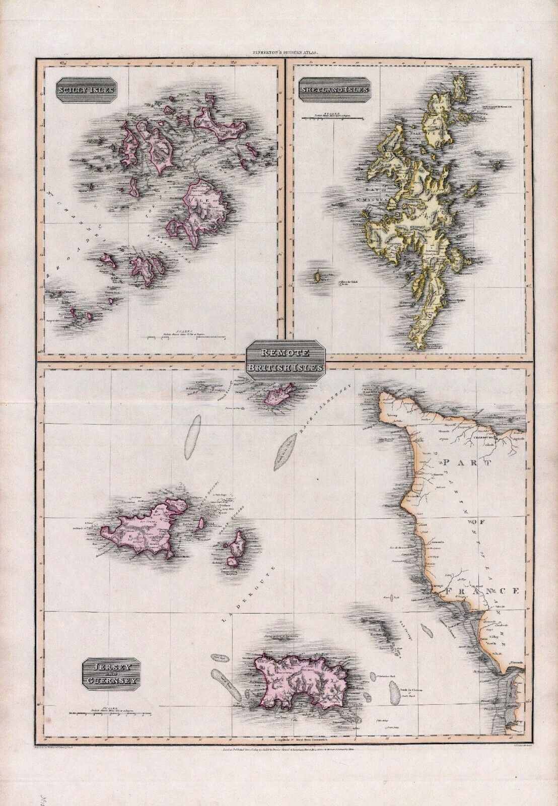
1815 Pinkerton map POSTER British isles Shetland Scilly Jersey Guernsey 14
$ 8.44
- Description
- Size Guide
Description
This Auction is for a LARGE unframed MODERN REPRINT of an Antique map as Pictured.This map is reproduced on specially coated, matte finish, paper for sharper print quality and colors that are vivid. Approximate Image Size
John Pinkerton A modern atlas, from the latest and best authorities, exhibiting the various divisions of the world, with its chief empires, kingdoms and states, in sixty maps, carefully reduced from the largest and most authentic sources. Directed and superintended by John Pinkerton, author of Modern geography, &c. London: Printed by T. Bensley, Bolt Court, Fleet Street; for T. Cadell and W. Davies, Strand; and Longman, Hurst, Rees, Orme, And Brown, Paternoster Row. 1815.
Size: 16.5 X 22 inches.
I HAVE MANY HISTORIC REPRINT MAPS AND OTHER ITEMS ON MANY DIFFERENT SUBJECTS. Please check out store for additional products.
I SHIP ALL MAPS ROLLED IN A MAILING TUBE TO PROTECT THE MAP.
